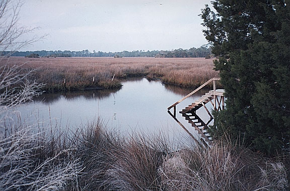
Cedar Island (or Sandpiper) Spring
County
Summary of Features
- Scale - 2nd magnitude
- Scenery - fine
- How Pristine? - steps to spring and development nearby, but spring very natural
- Swimming - good
- Protection - very good
- Crowds - small
- Access - very good
- Facilities - poor
- Safety - very good
- Scuba - no
- Cost - free

Directions
From the town of Salem, turn west off U.S. 19/98/27A onto Fish Creek Road and drive about 12 miles to State Road 361. Turn right (north) on SR 361 and drive about 1.5 miles to entrance to Cedar Island development. Turn left (west) into development. Take the second right onto Egret Lane and follow around left past a house on the right to dock/steps and sign for Sandpiper Spring.
Spring Description
This submarine spring forms an oval pool approximately 80 by 125 feet in a tidal salt marsh adjacent to the Gulf of Mexico. The bottom slopes downward from the shore to a depth greater than four feet, which was the limit of visibility at date and time of visit at low tide (evening, February 2001). No flow was visible. A wooden walkway and steps lead into the spring from the adjacent parking area,and there are a couple of cedar trees between the spring and the road.
Use/Access
A sign at the spring notes that its use is for residents of the Cedar Island subdivision and the spring appears to be used for swimming.
Springiana
The sign at the site calls the spring Sandpiper Spring.
Personal Impressions
The spring is in an attractive setting and is very accessible due to the wooden steps into the water. The authors would like to return on a sunny summer day and snorkel the site but would need to get permission to do so.
Nearby Springs
- Blue Spring
Other Nearby Natural Features
- Econfina River State Park
- Wacissa River/Slave Canal
- Wakulla Springs State Park
- St. Marks National Wildlife Refuge
