Clifton Spring
Seminole County
Summary of Features
- Scale -3rd magnitude
- Scenery - good-very good
- How Pristine? - houses nearby, site of old development
- Swimming - no
- Protection - unknown
- Crowds - small to none
- Access - good-very good to runs, springs not accessible
- Facilities - none
- Safety - good
- Scuba - no
- Cost - free

Directions
From intersection of Central Florida Greeneway (Highway 417) and Highway 434 in Seminole County, go left (east) onto Highway 434. Turn right (north) onto Spring Avenue, the first road after going under (west of) the Greeneway. Proceed 0.68 miles to the springs at historic marker for White's Landing.
Spring Description
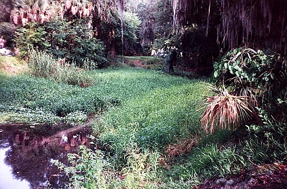
There are two spring pools at this site, which is on the most southern edge of Lake Jessup. The eastern pool is formed by the combined flows of three small springs that lie about 1,000 south of the lake. The creek formed by these springs is 2-3 feet wide and 1-2 inches deep. It flows under Spring Avenue to form the eastern spring pool. Nearest the road, the pool is filled with reeds. The northern section is clear of plants, oval, and about 60 by 100 feet. The pool opens directly into Lake Jessup. Visibility in the pool was about 3 feet on date of visit in June 2001. The spring water has a strong sulfur odor.
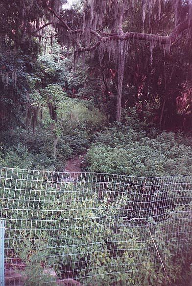
The three springs that feed the eastern pool are on private property and were not visited by JF. They are described (based on their appearance in 1972) as follows by Rosenau et al.:
Spring #1 consists of several small sand boils, each about 1 inch in diameter. . . . Most of the sand boils are in water about 3 feet deep.
Spring #2 is at the head of a small gully in a thickly wooded site. . . . The spring rises from a sand bottom inside and 3 feet below the top of a 39-inch diameter clay pipe buried about flush with the land surface. Water overflows the lip of the pipe to flow . . . southwestward.
Spring #3 has a circular pool about 15 feet across and about 3 feet deep at its deepest point. Flow is from several small sand boils about 1 foot in diameter in the pool bottom. (1977, p. 334)
These three springs flowed into a manmade impoundment as described based on the 1972 visit.
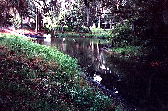
The western pool contains Spring #4 and is about 250 feet from the eastern pool. The spring forms teardrop-shaped pool about 90 feet wide. Its run is 20-30 feet across and about 100 yards to Lake Jessup. The edge of the spring could not be accessed, so its clarity and depth could not be determined. Like the other springs at this site, it has a strong sulfur odor. The point of land between the two spring runs is partially cleared hardwood forest. A short description of the springs is also provided by the St. Johns Water Management District
Use/Access
- Springs #1-3 are on private property, so only the lower portion of the run, the spring pool, and the mouth of the run into Lake Jessup can be seen.
- Spring #4 is surrounded by houses, but the land on the east side of its run is a county historic site with access for the visitor. The spring may be viewed from a distance of about 125 feet.
- Spring #4 has docks from the surrounding houses, and appears to be used by the residents to access Lake Jessup.
Personal Impressions
The springs have a lot of historic significance, but appear to be all but forgotten today.
Springiana
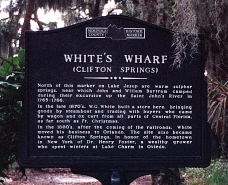
As noted on the historic marker at the site (see photo of marker below), Clifton Springs was visited by John and William Bartram in the 1760s. In the 19th Century, there was a major boat landing for Lake Jessup between the two springs. There have also been fish camps on the site. Today, the main features at the site are the nearby houses and the massive expressway bridge which can be seen from the mouth of the runs.
Nearby Springs
- Wekiwa Springs
- Rock Springs
- Elder Spring
- Lake Jessup Spring
- Palm Spring
- Sanlando Spring
- Miami Spring
- Starbuck Spring
- Gemini Springs
- Seminole Spring
- Green Spring
- Health Spring
- Volusia Blue Spring
Other Nearby Natural Features
- Blue Springs State Park
- Hontoon Island State Park
- Wekiwa Springs State Park
- Ocala National Forest
- Tosohatchee State Reserve


