Poe Spring
Alachua County
Summary of Features
- Scale -2nd magnitude
- Scenery -fine
- How Pristine? -retaining wall, beach area, walkway along spring and run,developed swim/recreation area
- Swimming -outstanding
- Protection -excellent
- Crowds -heavy on warm weekends
- Access -Fine, land or water
- Facilities -Excellent
- Safety -Fine
- Scuba -yes
- Cost - Ages 5-under: free
6-13: $3.00
14-61: $5.00
62-up: $3.00
Visitors (by car or by boat, may visit for 30 minutes without charge.

Directions
By Land: From High Springs, drive south on US 41/27 about onemile. Turn west (right) onto State Road 340 (Poe Springs Road) and proceedabout 2.5 miles to entrance to Poe Springs County Park. Follow signs tothe spring, which is a ¼ mile walk from the parking area.
By Water: From downtown High Springs, drive northwest on U.S.27/SR 20 about 2.5 miles to where the highway crosses the Santa Fe River.A launch ramp and parking area are just past the river on the right (north)side of the road. Canoe about 1.75 miles downstream to Poe Springs CountyPark on the left. Look for picnic enclosures and a sign for the park. Alternatively,put in at the boat ramp in Poe Spring County Park and go upriver about1/3 mile to the spring.
For maps, latitude/longitude data, driving directions, satellite imagery,and topographic representations as well as weather conditions at this spring,go to Greg Johnson's informative "Florida Springs Database" web site atthe following address: http://www.ThisWaytothe.Net/springs/floridasprings.htm#Florida
Spring Description
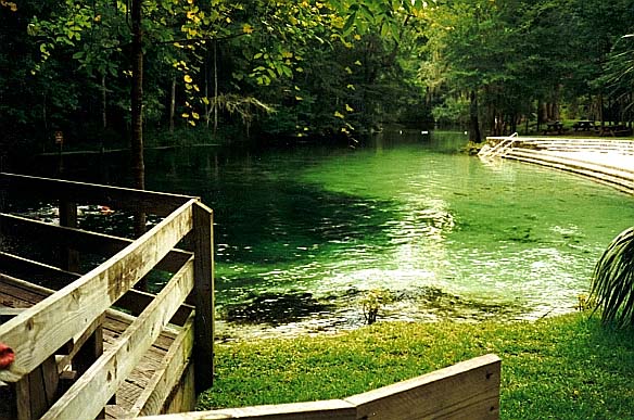
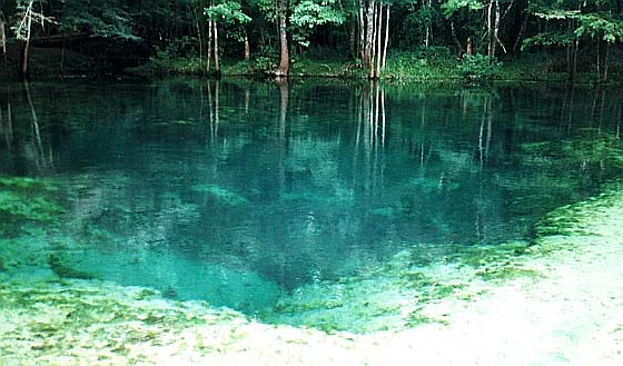
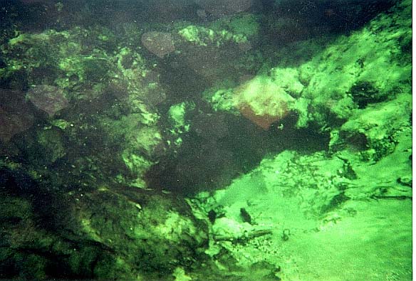
Flow from at least three vents creates a circular pool that is about80 feet in diameter, and about 18 feet deep at the deepest (and most powerful)vent. Water flows from limestone openings. The main openingis several feet across and large enough to admit a diver. The poolbottom is sandy, and water is very clear with a tint that varies from blueto green depending on conditions. The flow creates a shallow run(2-4 feet deep) that flows about 200 feet and which is about 40 feet wide. A retaining wall has been constructed on the north end of the spring,with an artificial beach and concrete steps leading to the water. The south end of the spring is swampy forest.
Rosenau et al., 1977 note there are several seeps and small springsin the vicinity of Poe (p. 63). One such spring is located 250 feetdownstream of where the Poe Spring run enters the Santa Fe River, alsoon the south bank of the Santa Fe. The spring is adjacent to thebank and consists of three small flows from openings in small (1-2 feetin diameter) limestone boulders at a depth of about 18 inches. Eachvent creates a small slick, and the three vents are in an area perhaps6 feet in diameter. The water is clear, but the bottom and limestoneare covered in dark algae and other plant growth, and the openings werenot visible. The springs were about 10 feet from the bank, whichrises a few feet in an area of hardwood forest. Wes Skiles told JFthat there is another small spring just in from the riverbank below themouth of the Poe run. This spring flows back away from the riverand empties into the run.
Use/Access- spring is good for wading.
- The spring area has picnic facilities.
- Signs on the bank, directed at canoeists and boaters, say "$4 Entry Fee,"so be prepared to pay if you set foot ashore.
- A rope blocks across the mouth of the spring run blocks access to the spring.
- The park has pay areas, a concession stand, ample parking, ball fields,meeting facilities, a dock, and a boat ramp.
Springiana
According to Rosenau et al. (1977), Poe Springs was developed as a commercial swim and picnic area in the 1940s. There is no evidenceof the earlier retaining walls, bathhouses, or other structures on thesite.
Personal Impressions
When JF first visited Poe in 1996, he was struck by the "deadness"of the site. Whereas most springs are teeming with flora and fauna, Poehad no fish and its bottom was choked with dead, black, rotting roots and other vegetative debris and detritus. Most of this material was gone when the spring was visited again in April and July, 2000, but there was little evidence of flora or fauna in the water.
Nearby Springs
- Ginnie Springs group
- Darby Spring
- Hornsby Spring
- ALA112791
- ALA930971
- Lily Springs
- Pickard Springs
- COL101971
- Rum Island Springs
- Blue Spring
- Naked Spring
- Johnson Spring
- Ginnie Springs group
- Sawdust Spring
- COL1012972
- COL1012971
- GIL1012973
- Myrtle's Fissure
- GIL1012971
- GIL1012972
- 47 Boatramp Spring(or GIL1012974)
Other Nearby Natural Features
- Ichetucknee Springs State Park
- O’Leno State Park
- San Felasco Hammock State Preserve
- Devil’s Millhopper State Geologic Site
- River Rise State Preserve
- Mike Roess Gold Head Branch State Park


